The end of the old Charlestown Bridge, once a key El link

Adam Castiglioni has been watching crews disassemble the old Charlestown Bridge, also known as the North Washington Street Bridge, between the North End and Charlestown. Today, he reports:
The last part of the Charlestown Bridge center swing trellis is gone and awaits dismantling on a barge.
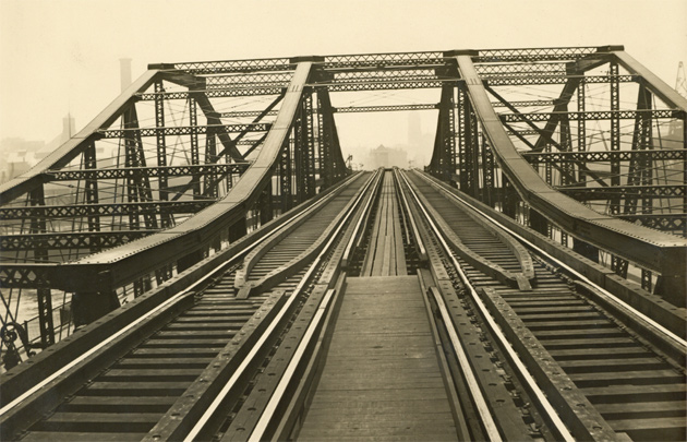
The bridge, which connected the USS Constitution to the Freedom Trail, had long been a main thoroughfare for both pedestrians and motor vehicles, with the center section able to swing to let boats through. It used to have a second deck, which connected what is now the Orange Line from North Station to points north via Charlestown:
The train tracks in 1901 - the year after the bridge opened (Boston City Archives):

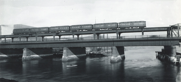
A six-car train crossing the bridge (Boston City Archives):

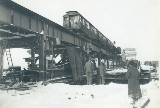
A Boston Elevated train crossing the bridge in 1945 (Boston City Archives):

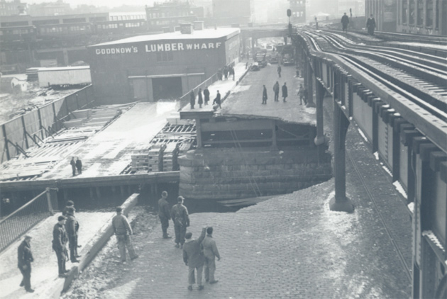
The 1945 picture was taken three days after a wartime Liberty ship crashed into the bridge due to a junior crewman misunderstanding directions from the bridge crew, taking out a chunk of the lower level (Boston City Archives):

Ad:

Comments
When did this bridge last swing open for boats?
I have never seen it do this.
Opening the bridge hasn't
Opening the bridge hasn't been possible in many, many years. There were pipes and continuous guardrails across the moving section, and they didn't look new. https://goo.gl/maps/A3AggPejffq4FZc3A
Adam - Edit Needed
Goodnow's Wharf is now 585 Commercial Street, what was Willard Mitt's Presidential Headquarters and is now a Boston Public School.
Lovejoy Wharf would be to the right on the other side of the tracks. You can just make out 226 Commercial Street on the right.
You can see in the background storage tracks going down Commercial Street by Prince Street / the Brinks Garage. This was part of the Atlantic Avenue line that was taken down mostly in 1942 ("Scrap to Lick The J*p!") but this part stayed up for a little while.
Tennis
Goodnow's Wharf is actually a pair of public tennis courts.
Thanks!
The dangers of looking things up and then not checking them properly! I've deleted the reference until I can figure out what that wharf really was.
Parts of the Atlantic Avenue
Parts of the Atlantic Avenue El survive inside current and former BERy & MBTA properties. The steel girders and beams were salvaged and repurposed for roof reinforcement in several maintenance facilities and garages to increase clear spans between columns as the bus fleet grew.
Goodnow Wharf & Storage
I can remember as a very young boy in the early 1950’s Gabriel Piemonte (later to become City Council President) owned a large car wash where the tennis courts are now. The car wash closed down sometime in the late 1950’s and or early 1960’s.